


The Teno Massif in Tenerife: Hidden Villages, Cliffs and the End of the World
At the north-western tip of Tenerife, the Teno massif looks as if it never quite joined the rest of the island. It is the oldest corner of Tenerife, where roads turn into tight hairpins at the edge of the void, where villages are just a handful of houses clinging to the slope, and where the land ends abruptly in the Atlantic facing a lonely lighthouse.
You may already have seen Masca, its best-known village, but the Teno massif is much bigger than that. Here is what you need to understand what you’ll be driving through before you go, and how to plan your visit.
🎯 Key facts
🌋 Age: The oldest massif in Tenerife, older than Teide
📍 Villages: Masca, Santiago del Teide, Buenavista del Norte, El Palmar, Las Portelas
🚗 Access: TF-436 road, very winding, so take care and be patient
🏝️ Highlight: Punta de Teno, the end of the world with its lighthouse, shuttle access at peak times
⏱️ Duration: Allow at least half a day to enjoy it without rushing
A massif older than Teide itself
The Teno massif is one of the three ancient volcanic massifs that gave birth to Tenerife, along with Anaga at the other end of the island and the Adeje mountains in the south. It formed several million years ago, long before the activity of Teide, which later filled the space between these three points to give the island its current triangular shape.
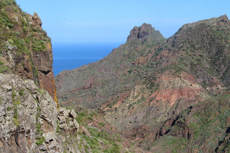
This geological past explains the landscape you find there today: terrain eroded over millions of years, steep cliffs plunging straight into the ocean, and deep valleys like the one at Masca, carved by erosion rather than shaped by a recent eruption.
Masca, the village suspended above the ravine
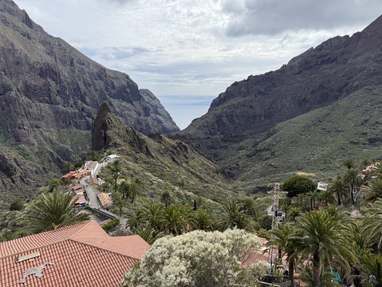
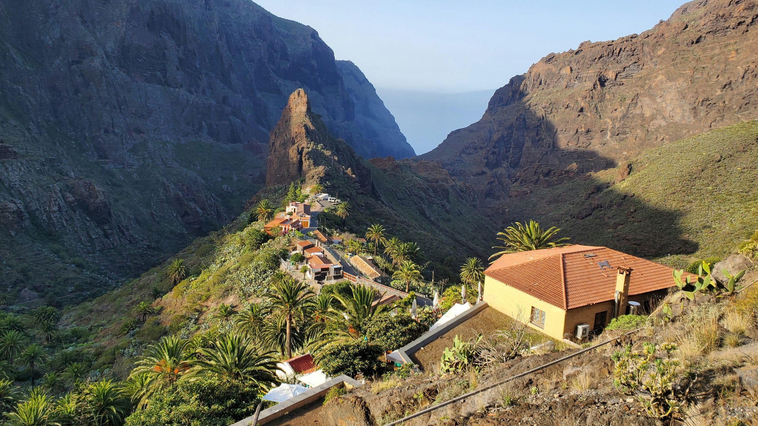
This is the best-known face of the massif: a mountain hamlet perched between 600 and 750 metres above sea level, at the edge of a spectacular ravine that runs down to the ocean. We’ve already dedicated a complete guide to it, with all the practical tips for enjoying it, the road to get there and the viewpoints not to miss.
The famous Barranco de Masca, the hike that goes down the ravine to the sea, now requires a mandatory booking and a guide, following the regulation introduced by the town hall to protect the site. If you don’t plan to do it, the village is very easy to visit on foot in an hour, with several viewpoints reachable without any particular effort.
For the descent of the Masca Gorge (official track, elevation profile and rules), see our Masca Gorge hike fact sheet.
Santiago del Teide and Buenavista del Norte, the two gateways to the massif
Two villages frame the massif and serve as logical starting points depending on where you’re coming from. Santiago del Teide, to the south-east, is the most convenient entrance if you’re arriving from Los Gigantes or Costa Adeje: the road there is a little more gradual. Buenavista del Norte, on the north coast, is the starting point for reaching Punta de Teno and a good base if you’re coming from Garachico or Icod de los Vinos.
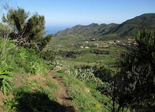
Between the two, the hamlets of El Palmar and Las Portelas are worth the detour for anyone who wants to leave the busiest trails: terraced farming valleys, silence, and a real feeling of being at the end of the world, only a few kilometres from the tourist areas of the south.
For hikers, the massif also offers the descent of the Camino del Risco, from Teno Alto to Buenavista del Norte: 3.7 km, about 2 h 20, moderate difficulty. The map, profile and all the details are in our guide.
Punta de Teno, the real end of the world
This is the westernmost point of Tenerife: a lava platform battered by the ocean, with a lonely lighthouse and a view that reaches the cliffs of Los Gigantes in clear weather. The place was hard to reach for a long time, and for good reason: the road leading there from Buenavista del Norte is regulated, with traffic restricted at times of heavy demand to protect the site.
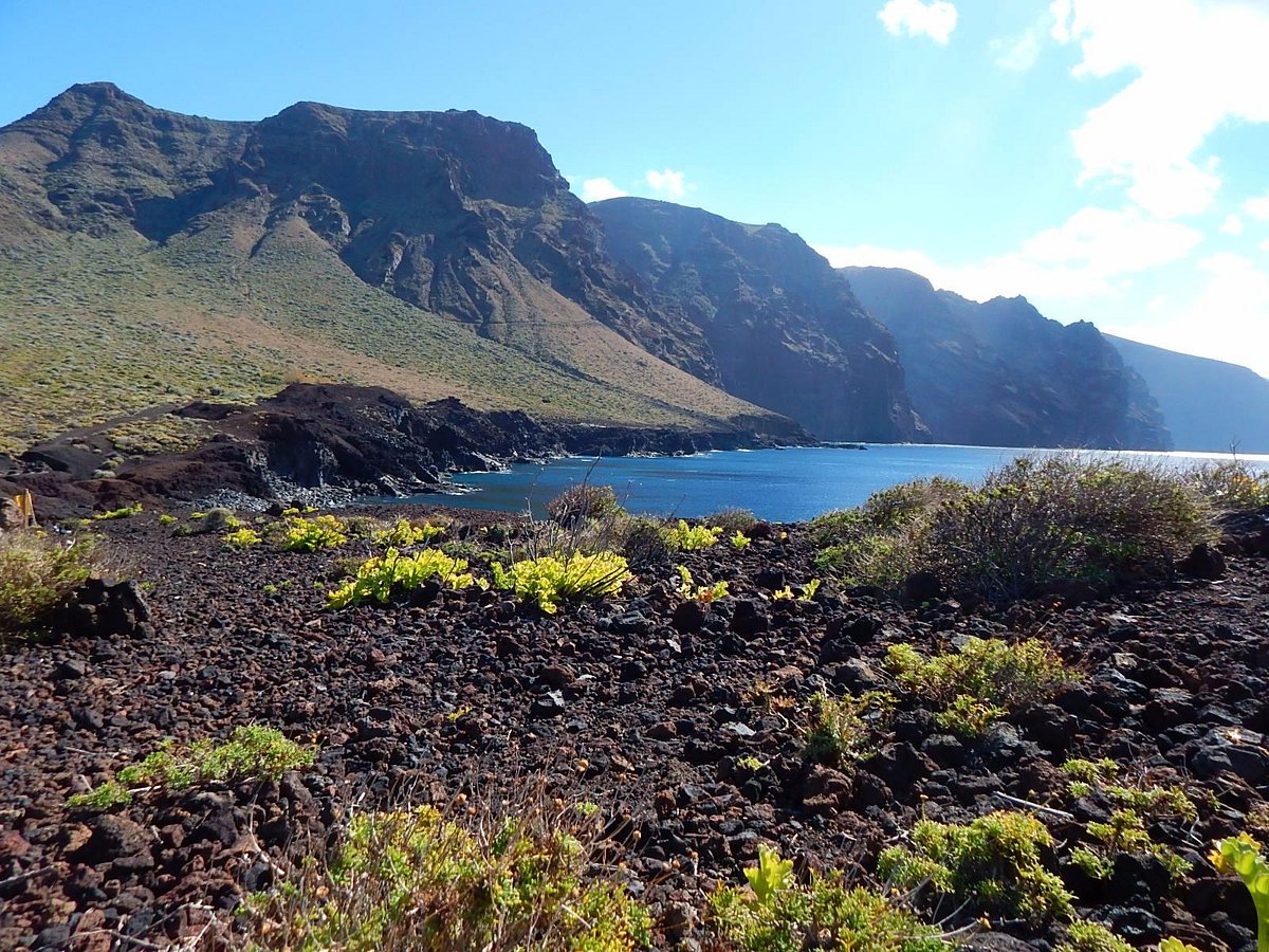
In practice, in high season and at peak times, access by private car is limited and replaced by a shuttle from Buenavista del Norte. Check the current timetable before you go if you plan to get there in the middle of the day, to avoid arriving in front of a closed barrier.
The road, the viewpoints and what to expect
The main road through the massif, the TF-436, is known across the island for its hairpin bends and its sheer drops without guardrails on some stretches. It is not a road to take lightly if you don’t often drive on this kind of terrain: drive slowly, give way to the buses that also use it, and avoid blind overtaking.
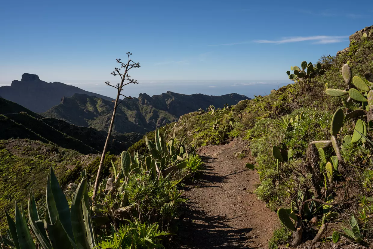
In return, nearly every bend opens onto a new view. The Masca viewpoint, just before the entrance to the village when coming from Santiago del Teide, is the most photographed, but several informal viewpoints along the road are well worth a stop of a few minutes, especially late in the day when the light skims the cliffs.
Planning your visit to the Teno massif
Allow at least half a day to discover the massif without rushing: the road itself takes time given how winding it is, and every stop deserves a little lingering. A full day lets you combine Masca, the viewpoints along the road and Punta de Teno without running.
It’s better to set off in the morning to enjoy softer light on the cliffs and avoid the worst of the crowds at Masca in the middle of the day. If you’re organising your stay around the north-west of the island, the Teno massif combines naturally with Los Gigantes, its dizzying cliffs just to the south, and with our guide to the north of Tenerife, which brings together everything to see in this area.
Where is the Teno massif in Tenerife?
At the north-western tip of the island, between Santiago del Teide, Buenavista del Norte and the coast. It is one of the three ancient volcanic massifs that form the geological base of Tenerife.
Do you need to book to see Masca?
Not to visit the village itself, which can be explored freely on foot. However, the Barranco de Masca hike down to the sea requires a mandatory booking and a guide.
How do you get to Punta de Teno?
By a road from Buenavista del Norte, where traffic is regulated at times of heavy demand, with a shuttle then replacing access by private car. It’s better to check the current timetable before you go.
Is the road through the Teno massif difficult to drive?
Yes, the TF-436 is winding, with tight bends and some stretches without guardrails. It calls for caution, especially if you’re not used to this kind of mountain road.
How long should you allow to visit the Teno massif?
At least half a day for Masca and a few viewpoints. A full day lets you add Punta de Teno without rushing.
Read also: Garachico: what to see in the historic town, the most beautiful villages in Tenerife, the Agujero de Tamaimo, Buenavista del Norte and Los Silos.