


Anaga Lighthouse and Chamorga: the PR TF 06 hike from El Draguillo (map, profile and tips)
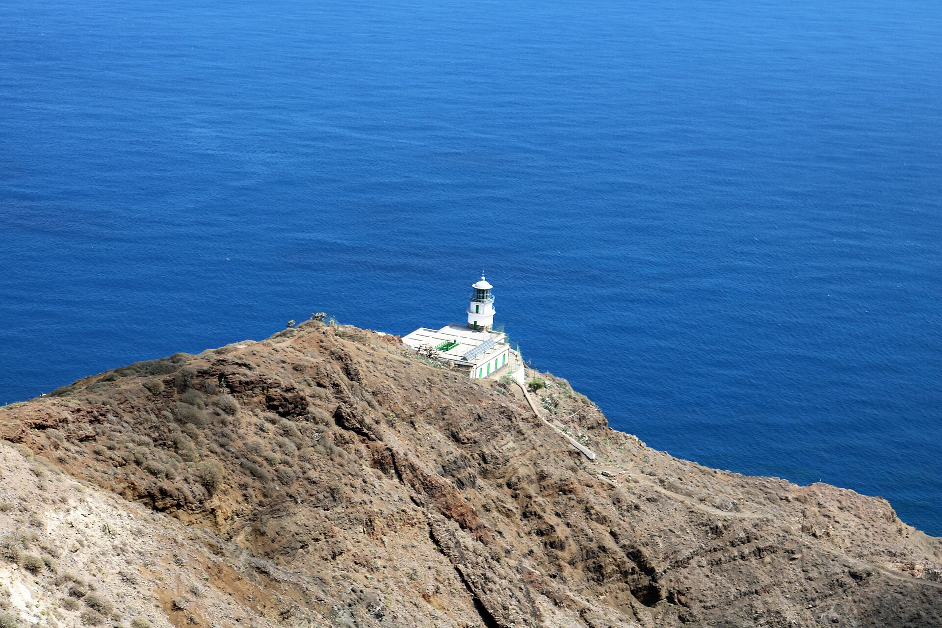
The PR TF 06 trail links the hamlet of El Draguillo to the Anaga lighthouse via the village of Chamorga, at the far north-east of the Anaga massif. It is a trail with steep gradients, rated high difficulty: 6.80 km, 841 m of cumulative elevation gain and 749 m of loss.
We have not done this hike ourselves yet: we give you what you need to set off without getting lost, and we will add our own experience later.
Anaga Lighthouse and Chamorga: the fact sheet at a glance
- 6.80kmDistance
- 4 h 40Estimated time
- +841mElevation gain
- −749mElevation loss
- 655mHighest point
- 70mLowest point
- One wayRoute type
- HighDifficulty
So you don’t get lost
- Start
- Hamlet of El Draguillo, reachable on foot only. GPS: 28.57831 / -16.17441. Google Maps directions · OpenStreetMap
- Finish
- Anaga lighthouse (Faro de Anaga), reachable on foot only. GPS: 28.58098 / -16.14169.
- Landmarks
- On the official track: Chamorga at km 2.6 (473 m altitude), the Anaga lighthouse at km 6.6 (235 m), end of the track at km 6.8.
- Transport
- TITSA bus 947, stop “Chamorga” (no. 1496). Parking spaces in the centre of Chamorga, halfway along the trail.
- Signage
- Posts and signs with the code PR-TF 06, yellow and white marks.
- Access
- Free, with no authorisation or booking (temporary measure until 31 December 2026).
- Variant
- There is also PR TF 06.1 Chamorga, Casas de Tafada and Faro de Anaga.
- Warning
- Steep trail, rated high difficulty. Stay on the marked path and call 112 in an emergency.
The route step by step
The track starts at El Draguillo, at 179 m, and climbs straight away: about 493 m at kilometre 1, then the high point, 655 m, around kilometre 1.4.
It then drops towards Chamorga, which you reach at kilometre 2.6, at 473 m. This is the village where you can park, and the halfway point: about 424 m at kilometre 3, 310 m at kilometre 4 and 185 m at kilometre 5.
After Chamorga the trail goes down to its lowest point, 70 m, around kilometre 5.6. It then climbs to the Anaga lighthouse, which you reach around kilometre 6.6, at about 235 m: roughly 165 m of climbing over the last kilometre.
The route is not a loop. If you start from Chamorga, where you can park, the section of the track to the lighthouse is about 4 km each way (from kilometre 2.6 to kilometre 6.6), so about 8 km out and back, going down on the way out and climbing back on the return. This is not an official itinerary: it is a calculation made from the official track.
Before you go
- Logistics: the track is linear. Bus 947 serves Chamorga (check TITSA timetables), and parking is in the centre of Chamorga, halfway along.
- Difficulty: rated high, with steep gradients. 841 m of elevation gain in under 7 km.
- Time: 4 h 40 announced for the whole track. Allow more with breaks.
- Water: there is no water point on the route, so carry what you need.
- Rules: Anaga Rural Park, stay on marked paths and do not enter private property.
Gear: we put the essentials together in our hiking gear checklist for Tenerife.
Frequently asked questions
How long does it take to reach the Anaga lighthouse?
The announced time is 4 h 40 for the 6.80 km between El Draguillo and the lighthouse. If you start from Chamorga, the trip to the lighthouse is shorter, but allow for the return too.
Do you need a permit to hike in Anaga?
Access is free, with no authorisation or booking (temporary measure until 31 December 2026). Check the Anaga Rural Park rules when you set off.
Can you get there without a car?
In principle yes: bus 947 serves Chamorga (stop no. 1496). Check the timetables on the TITSA website.
Where do you park?
There are parking spaces in the centre of Chamorga. El Draguillo itself can only be reached on foot.
Is there a shorter variant?
There is also PR TF 06.1 Chamorga, Casas de Tafada and Faro de Anaga. Check the up-to-date information before following it.
Keep exploring
For the rest of the massif, read our guide to Anaga Rural Park, our Bosque Encantado hike and our article on Roque de las Bodegas beach. You can also read about the village of Chamorga.
More hikes in this series: Roques de García, Siete Cañadas, Arenas Negras (Teide), Arenas Negras (Garachico), Vilaflor and the Lunar Landscape, Camino del Risco, Masca Gorge, Montaña Blanca (Teide), Cruz del Carmen to Punta del Hidalgo, Afur and Taganana.
Data checked on 27 October 2026. Trails can be closed or changed: always check official information before you set off.