


Playa de Antequera in Tenerife: the Remote Beach of Anaga, by Foot or by Boat
Playa de Antequera hides at the very end of the Anaga massif, at the north-eastern tip of Tenerife, in one of the most remote corners of the island. You can’t get there by car: you have to walk for several hours from Chamorga or Igueste de San Andrés, or reach the cove by boat from Santa Cruz. That is precisely what makes it one of the few spots in Tenerife to have kept a truly wild character.
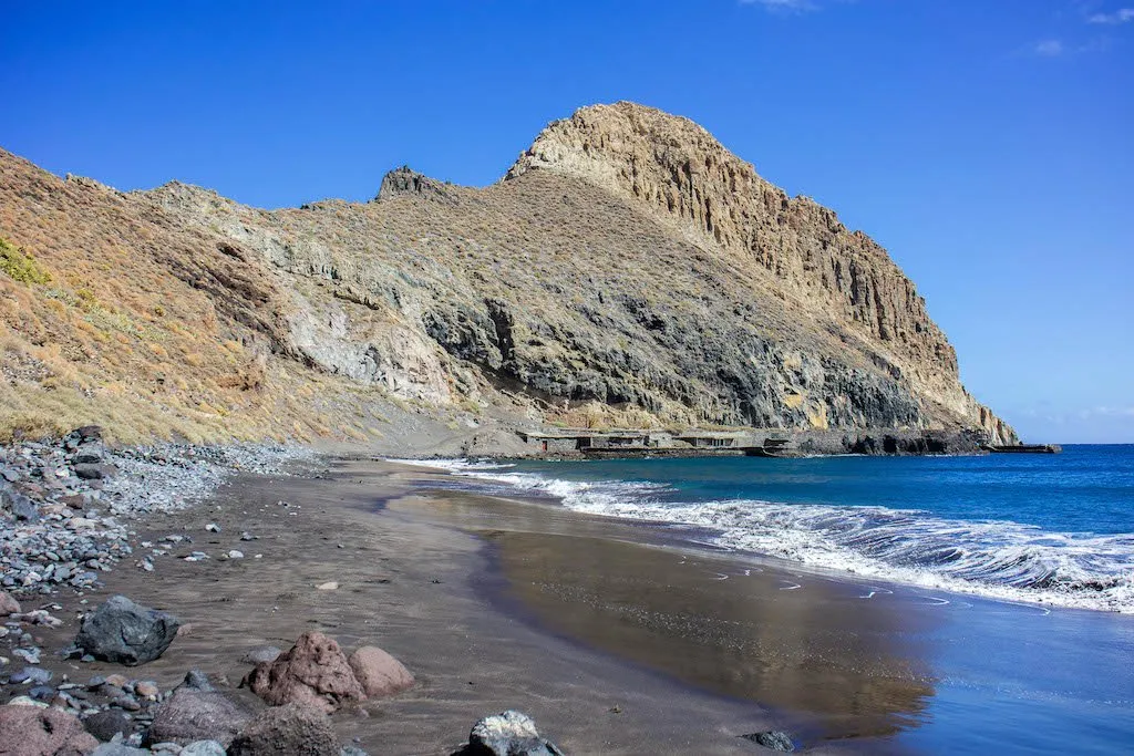
At the end of the effort: a beach of volcanic sand about 400 metres long, overlooked by the Roque de Antequera, and often only a few walkers or boaters for company. There is no chiringuito (beach bar) and no sunshade to rent here: what you come for is precisely the isolation.
🎯 The essentials
📍 Location: Anaga massif, municipality of Santa Cruz de Tenerife, at the north-eastern tip of the island
🏖️ Sand: volcanic, about 400 m long, width varies with the tide
🥾 On foot: about 3 hours from Chamorga (PR-TF 5 trail, the best waymarked) or from Igueste de San Andrés (longer, less well signed)
⛵ By boat: water taxi from Playa de las Teresitas, about 20 minutes, frequent in summer, by reservation in winter
📝 On site: no services or lifeguards: bring water, food and sun protection
ℹ️ Good to know: swimming is possible but the sea is sometimes rough because of the trade winds, so it is better to check conditions before you go
Where Playa de Antequera is
The beach is in Anaga Rural Park (Parque Rural de Anaga), the north-eastern tip of Tenerife classified as a UNESCO biosphere reserve. It occupies a small cove at the foot of the Roque de Antequera, a rocky pinnacle that serves as a visual landmark from the trail as well as from the sea. This stretch of coast, wedged between the villages of Chamorga and Roque Bermejo, has no road at all: it is this isolation that has preserved the beach from any development.
The hike from Chamorga, the safest option
The start is at kilometre 9 of the TF-123 road towards Chamorga, where the track branches off towards the village cemetery. The trail, waymarked PR-TF 5, gradually descends the Antequera ravine (barranco) for about 6.4 km (one way), around 3 hours of walking. The landscape changes along the way: the humid laurisilva at the start gives way to more arid vegetation, cardones and tabaibas, as you approach the coast. It is a moderate but real route: good shoes and legs ready for the climb back are needed.
From Igueste de San Andrés, longer and less waymarked
Another option starts from Igueste de San Andrés, but the trail there is much less well signed: several hikers report sections where you have to spot cairns and paint marks on the rock rather than proper waymarking. This variant is longer and more suited to experienced walkers who can find their way without a preloaded GPS route. For a first visit, the route from Chamorga remains the safest choice.
Reaching the beach by boat
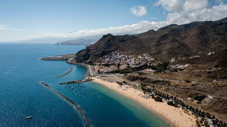
If the hike doesn’t tempt you, a water taxi regularly links Antequera from Playa de las Teresitas, in Santa Cruz, in about twenty minutes. The service runs frequently in summer and by reservation the rest of the year. It is also a good option for doing the hike in one direction only, and coming back by sea rather than climbing back up the same path.
What the beach is like once you get there
The sand, volcanic in colour, stretches for about 400 metres, but its real width depends a lot on the tide: at high tide, only a few usable metres sometimes remain at the foot of the cliff. The Roque de Antequera overlooks the cove on the north side, and the place is generally very quiet, even in high season, simply because few visitors make the effort to come.
Swimming at Antequera: what to know
Swimming is possible, but with no supervision at all and with a sea that can become rough because of the trade winds. It is not a sheltered beach like those in the south of the island: it is better to look at the state of the sea before getting in the water, and stay careful outside the calmest days, which are fairly common in summer.
How long to allow
For the round-trip hike from Chamorga, allow a full half day including time on the beach: about 3 hours of walking each way, with time on the beach in between, then 3 hours back. By boat, the visit can be limited to a few hours, transport included. In any case, it is better to set off early to enjoy the light and avoid the hottest hours on a route with no shade on its last part.
What to bring
There are no services on site: enough water for the round trip, food, sunscreen and a hat are essential, as are good hiking shoes for the trail. A bag to carry your rubbish back is also a must, since there are no bins on this isolated stretch of coast.
Other isolated routes in the massif await the most motivated hikers, such as the Bosque Encantado. For more accessible beaches elsewhere on the island, head to our selection of beaches and coves in Tenerife.
How long does it take to walk to Playa de Antequera?
Allow about 3 hours from Chamorga along the PR-TF 5 trail, the best waymarked of the two access routes. Allow the same for the return, unless you choose to leave by boat.
Can you swim at Playa de Antequera?
Yes, but with no supervision at all and sometimes a rough sea because of the trade winds. It is better to check conditions before you go and stay careful.
How do you get to Playa de Antequera without hiking?
A water taxi links the beach from Playa de las Teresitas in about 20 minutes, with a frequent service in summer and by reservation in winter.
Are there services on site (restaurant, showers, sunshades)?
No, no services at all. You have to bring everything (water, food, sun protection) and leave with your rubbish, since the beach has no bins.